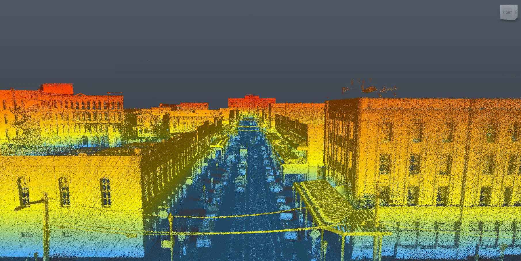
Street Level LiDAR service at Travel Speed
LIDAR System
- 700,000 points per second
- +1 cm Laser accuracy
- 100 m laser range
- Integrated GNSS, IMU, FOG
- Absolute Accuracy 0.02 m =0.05 m
- Requires no user calibration
- Survey speeds up to 70 mph
- Operates in all weather conditions

360° Spherical Camera
- Real-time stitching of 360° images and 360° videos
- UHD video & 30 MP Imagery covering 90% of a full sphere
- Pause recording at any time, then continue once ready
- Compress 360° Videos while maintaining video quality
- High bandwidth Interface 5Gbit/s (USB 3.0)
- GPS data is automatically synchronized with each frame
- Full software API for custom application development
Deploy & Acquire 3D Data in Minutes
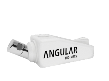
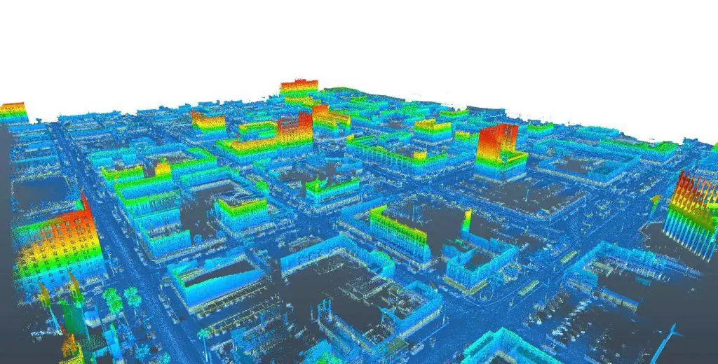
The Angular HD Mobile Mapping System utilizes the latest instruments in dynamic geospatial data collection technology and enables our team to collect quality 3D Geospatial data at travel speed. Reality IMT can bring hundreds of miles of corridors onto your desktop using this technology.
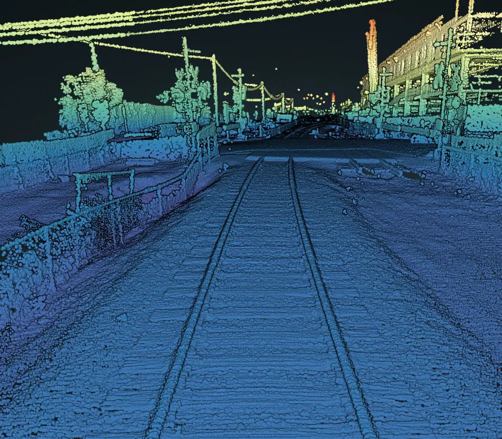
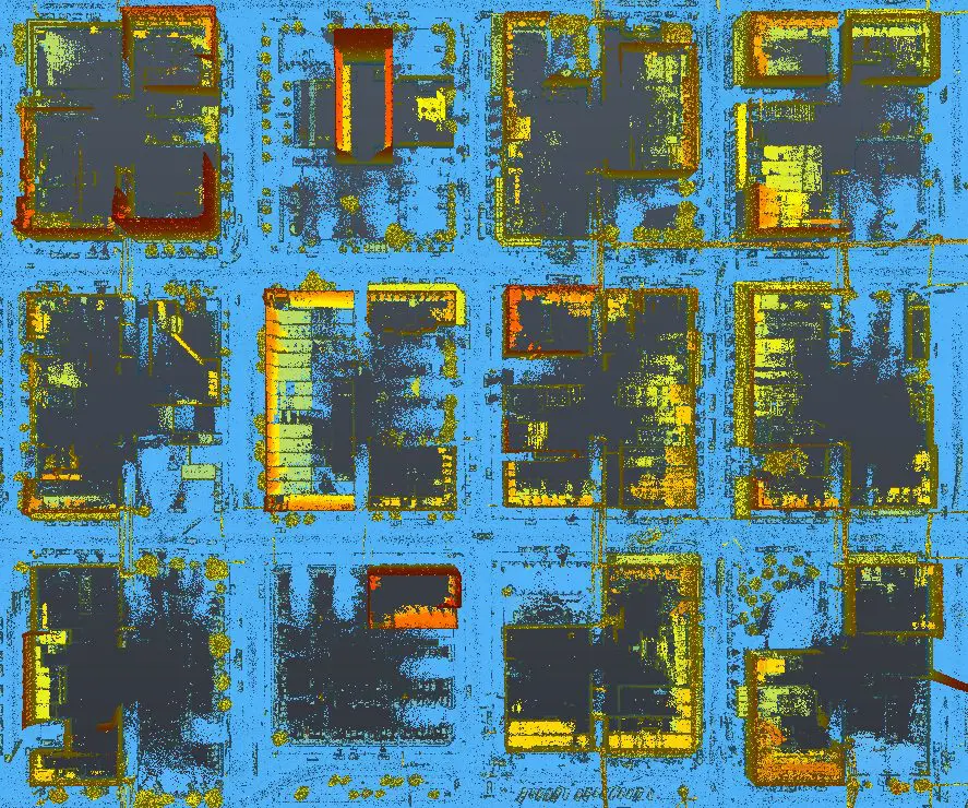
Delivering up to 700,000 data points per second the system can be used at highway speeds, making it an ideal solution for city mapping, Urban Planning, Infrastructure Assessment, Roadway Asset Inventory, Railroad As-built, Corridor Mapping, Power Line Surveys, Pipeline surveys, Volumes and much more.
Versatile Geospatial Technology
Modular, lightweight & can be collect be shipped to the project site within hours.
The compact form factor and light weight of the Angular HD MM allows the system to be fitted to almost any type of mobile platform in a matter of minutes. The system has been designed to be simple to mobilize and easy to operate without the need for specialized training or qualifications. Being able to rapidly acquire accurate geospatial data in real time, without the need for post processing, not only offers a number of cost and efficiency benefits to existing operations, it also helps create new business and market opportunities.
Can be fitted on any Vehicle, ATV, Hy-rail or Boat
The HD Mobile Mapping System is delivered as a fully calibrated-ready to go mobile mapping solution, complete with PC and software. The system requires no user calibration or configuration and can be mounted on any type of mobile platform and be ready to acquire accurate 3D Geospatial data within minutes. Training is included with every system together with 12 months 24/7 telephone and remote internet support.
Turnkey Mobile Mapping Solution
- Acquire Geo-referenced point cloud on the fly
- Extract features immediately after acquiring the data
- Deliver CAD, GIS, Geo-imagery & Geo-video
360° SPHERICAL CAMERA IMAGING SYSTEM
| AID Converter | 12-bit |
| Image Data Output | 8-, 12- or 16-bit, Raw or J PEG compressed |
| Image Data Formats | Raw8, Raw12, Raw16 in uncompressed and JPEG |
| Partial Image Modes | Pixel binning and region of interest (ROI) modes |
| Image Processing | Shutter, gain, white balance, gamma and JPEG compression, are programmable via software |
| Shutter | Global shutter; Automatic/manual/one-push/extended shutter modes 0.02 ms to 2 seconds (extended shutter) |
| Gain | Automatic/manual/one-push modes for 8-bit formats; manual mode for 12-bit formats 0-18 dB |
| Gamma | 4 0.50 to 4.00 |
| White Balance | Manual |
| High Dynamic Range | Cycle 4 gain and exposure presets |
| Digital Interface | USB 3.0 with locking screws for secure connection |
| Transfer Rates | 5 Gbit/s |
| GPIO | 12-pin GPIO connector for external trigger input, strobe output, and camera power |
| External Trigger Modes | Standard, bulb, skip frames, overlapped, and multi shot trigger modes |
| Memory Channels | 2 memory channels for custom camera settings |
| Case | Machined aluminum housing, anodized red or black; single unit, IP65 certified |
| Dimensions | 197 mm diameter, 160 mm height (with lens hoods) |
| Mass | 3.0 kg |
| Power Consumption | 12-24 V, 13 W via GPIO |
| Machine Vision Standard | IIDC v1.32 |
| Camera Control | via Ladybug SDK, CSRs, or third party software |
| Camera Updates | In-field firmware updates |
| Optics 6 | high quality 4.4 mm focal length lenses |
| Field of View | 90% of full sphere |
| Spherical Distance | Calibrated from 2 m to infinity |
| Focus Distance | ~200 cm. Objects have an acceptable sharpness from ~60 cm to infinity |
| Environmental Sensors | Temperature, Barometer, Humidity, Accelerometer, Compass |
| Temperature | Operating: 0° to 4.5°C; Storage: -30° to 60°C |
| Humidity | Operating: 20 to 80% (no condensation) ; Storage: 20 to 95% (no condensation) |
| Compliance | CE, FCC, RoHS |
| Environmental Protection | IP65 |
| Operating System | Windows 7 or Windows 8, 64-bit with 8 GB RAM |
| Warranty | 2 Years |
Angular HD-MMS Specifications
| LiDAR SENSOR | |
| 32 laser/detector pairs | 905 nm Class-i Eye Safe |
| Horizontal Field of View (Degrees) | +10.67° to -30.67° |
| Vertical Field of View (Degrees) | 360° |
| Range (Meters) | 1m to typically 8om - loom |
| Frame Rate | 10 Hz Default (user selectable, 5-20Hz) |
| Accuracy | <2 cm (one sigma at 25 m) |
| Output | Up to 700,000 points/second (user selectable) |
| GNSS RECEIVER | |
| Simultaneous Tracking Channels | 240 |
| GPS Signals / GLONASS Signals | L1, L2, L2C, L5 /L1,L2 |
| Single Point Accuracy (Meters) | 1.20M |
| SBAS Accuracy (Meters) | 0.60m |
| Satellite DGPS Accuracy (Meters) | 0.40m |
| VBS Accuracy (Meters) | 0.60m |
| XP / HP Accuracy (Meters) | 0.15m / 0.10 |
| RTK / VRS Accuracy (Meters) | 0.01m + 1ppm |
| COMBINED GNSS IMU SYSTEM ACCURACY | |
| GYRO Type | Fiber Optic Gyro (FOG) |
| Accelerometers | MEMS |
| Pitch Accuracy (Degrees) | 0.015° |
| Roll Accuracy (Degrees) | 0.015° |
| Heading Accuracy (Degrees) — Stand Alone System | 0.050° |
| Heading Accuracy (Degrees) — External Antenna (1 m Baseline) | 0.030° |
| Heading Accuracy (Degrees) — External Antenna (2 m Baseline) | 0.020° |
| DATA OUTPUTS | |
| Communications Protocols | Ethernet TCP, Ethernet UDP, RS232, USB |
| Laser Data Output | Ethernet UDP - 700,000 Points Per Second |
| GNSS and IMU Data Output | Ethernet TCP - l00Hz |
| Timing Signals | GNSS 1 PPS and GPRMC (Programmable) |
| DATA INPUTS | |
| Command & Control | Ethernet (1 Gbyte) UDP, TCP |
| Programming | RS232, USB |
| RTK or VRS Correction Signals (RTCMv3 / CMR+) | RS232 |
| POWER | |
| Input Voltage | 9 - 32 Volts DC |
| Power Consumption | 30 Watts |
| PHYSICAL | |
| Dimensions (L x W x H) | 600 mm x 200 mm x 190MM |
| Weight | 12.0 kg (26.5 lbs.) |
| Environmental Protection | IP 65 |
| Shock | 500 m/sec2 amplitude, 11 msec duration |
| Vibration | 5 Hz to 2000 Hz, 3G RMS |
| Operating / Storage temperature | -10° to +60° C / - 40° to +105° C |
