Did you know?
According to a report by MarketsandMarkets, the global 3D scanning market size is expected to grow from $1.3 billion in 2020 to $3.7 billion by 2025 – with the construction and architecture industry being the fastest-growing segment.
This staggering figure tells us one thing: 3D Laser Scanning is not just a trend – it’s transforming the future of how we design, build, and manage buildings.
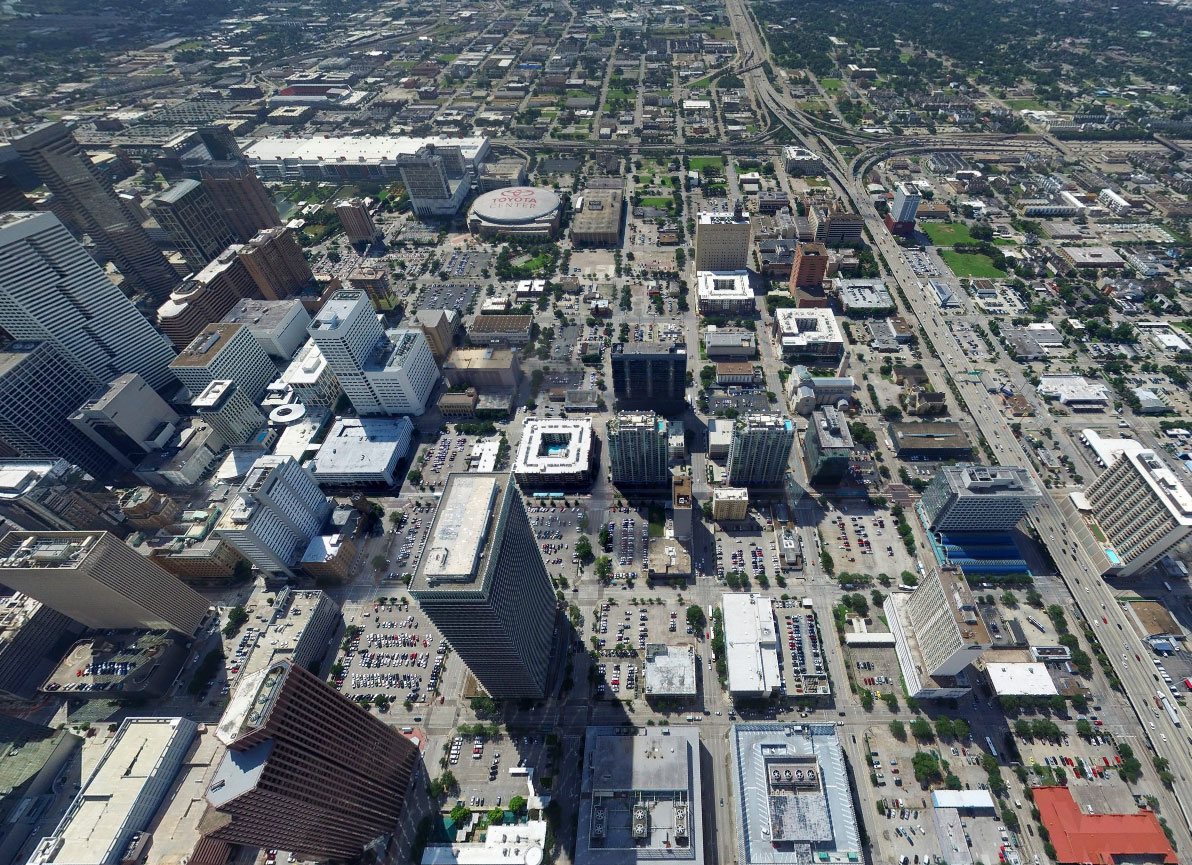
From skyscrapers in New York to public infrastructure in California, architects, engineers, and contractors are turning to 3D measurement services to minimize errors, increase efficiency, and improve safety. In this blog, we’ll dive deep into how 3D measurement services are revolutionizing building projects nationwide in the United States, the technology behind it, its benefits, and who should consider adopting it.
What Are 3D Laser Scanning Services?
3D measurement services involve the use of specialized scanning equipment and software to capture the exact spatial dimensions of physical objects or environments. In the building sector, these services are critical for:
- Capturing precise floor plans
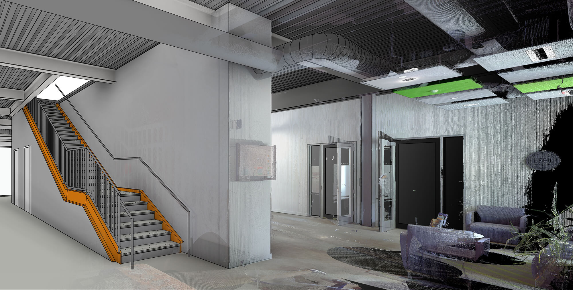
- Verifying as-built conditions
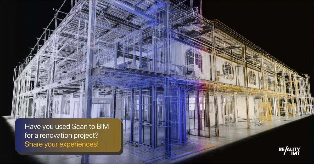
- Assisting with renovations and retrofitting
- Monitoring structural deformation over time
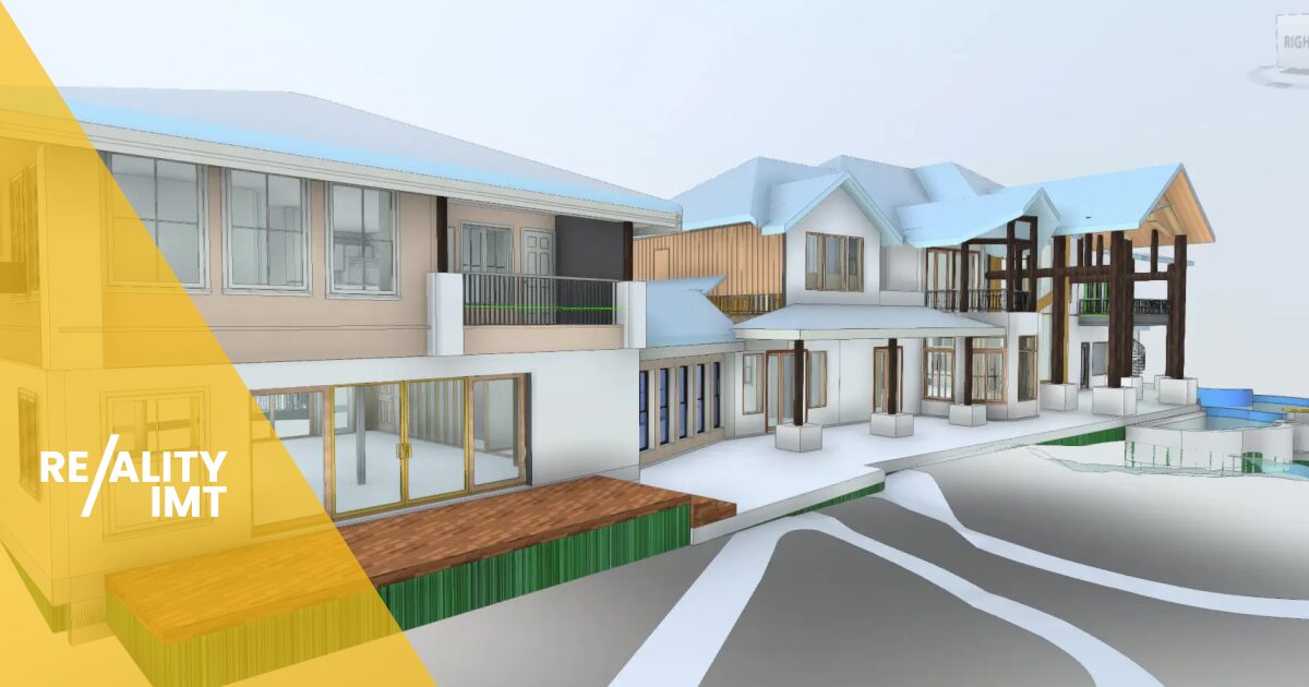
- Creating BIM (Building Information Modeling) models
Technologies used include LiDAR (Light Detection and Ranging), photogrammetry, laser scanning, and drones.
Why It Matters: The Hidden Costs of Inaccuracy
According to a study by PlanGrid and FMI Corporation, poor data and miscommunication cost the construction industry more than $177 billion annually in the US. A large portion of this is due to outdated or inaccurate measurements.
That’s where 3D measurement comes in. Instead of relying on manual measurements and 2D blueprints, 3D measurement services offer:
- Accuracy down to the millimeter
- Real-time updates
- 3D visualization for better stakeholder communication
Key Benefits of 3D Laser Scanning Services for Buildings
1. Increased Design Accuracy
By using 3D scanning early in the design phase, architects can work with precise site data, ensuring better design decisions and fewer changes later.
2. Efficient Construction Planning
Contractors can pre-plan routes for utilities, equipment placement, and structural components by using 3D models, leading to faster, more efficient construction.
3. Minimized Rework
Rework due to incorrect measurements or missed elements is one of the biggest cost drivers. 3D measurements reduce this significantly by providing exact data upfront.
4. Improved Safety
Laser scanning allows teams to capture hazardous or hard-to-reach areas without putting personnel at risk. This is especially crucial for tall buildings and infrastructure.
5. Faster Project Approvals
Local and federal regulators are increasingly requiring 3D documentation as part of building permits and inspections. Having this data readily available can speed up approvals.
Real-Life Application: How 3D Laser Scanning Services Support Building Projects
Let’s take a look at how these services are used in different phases of a construction project.
Pre-Construction Phase
- Land and site surveys
- Existing structure scanning
- Clash detection for planning MEP systems
Construction Phase
- Monitoring construction progress
- Verifying alignment of structures
- Ensuring proper placement of mechanical systems
Post-Construction / Facility Management
- As-built documentation
- Maintenance planning
- Future expansion/renovation support
Tools Used in 3D Building Measurements
- Terrestrial Laser Scanners (TLS): Great for high-precision scanning of building interiors and exteriors
- Drones with LiDAR Sensors: Ideal for large-scale commercial or industrial projects
- Handheld Scanners: Portable and used for capturing smaller spaces or details
- 3D Modeling Software: Such as AutoCAD, Revit, and Navisworks for creating visual models from raw data
Who Should Use these Services?
These services are beneficial for:
- Architects & Designers: For creating accurate models from the beginning
- Contractors & Builders: To monitor construction and reduce costly errors
- Real Estate Developers: For showcasing properties through virtual walkthroughs
- Facility Managers: For space planning and infrastructure management
- Government Agencies: For public projects like schools, hospitals, and transport systems
Trends to Watch
- Mandates for BIM in Government Contracts: Several US states now require Building Information Modeling in public projects, which starts with accurate 3D measurements.
- Rise in Smart Buildings: The need for sensors and IoT devices demands exact dimensions for installations.
Increased Demand for Green Construction: 3D scans help calculate material usage, reduce waste, and contribute to sustainability goals.
|
Problem |
Traditional Methods | 3D Measurement Services |
| Accuracy | High risk of error | Millimeter-level precision |
| Time | Slower and labor-intensive | Fast and automated |
| Cost | Higher due to rework | Lower over the full project lifecycle |
| Documentation | Paper-based or outdated drawings | Real-time, cloud-based data |
Cost vs Value: Is It Worth It?
While 3D measurement services may have a higher upfront cost, they offer up to 30% savings in total project costs due to reduced errors, faster workflows, and better planning. According to Dodge Data & Analytics, projects using 3D laser scanning reported a 50% reduction in change orders.
So yes, it’s not just worth it — it’s necessary for staying competitive in 2025 and beyond.
Frequently Asked Questions (FAQs)
1. How accurate are 3D laser scanning services?
Modern laser scanners offer accuracy of ±1 to 2 millimeters, which is significantly more precise than manual measurement methods.
2. What industries benefit the most from 3D building measurement services?
Construction, real estate, architecture, urban planning, and infrastructure development benefit the most from these services.
3. How long does a 3D building scan take?
A standard building scan can take a few hours to a full day depending on the size and complexity of the structure.
4. Is 3D measurement expensive?
While the initial scan might cost more than manual methods, the long-term savings in time, error reduction, and rework costs make it a smart investment.
5. Can these services be used for historical buildings?
Yes, 3D scanning is ideal for preserving heritage structures without physical disruption.
6. Do I need special software to view the results?
Most service providers deliver files that can be opened in industry-standard software like AutoCAD, Revit, or even web-based viewers.
7. Are 3D measurement services safe for buildings under construction?
Yes. In fact, scanning during construction enhances safety by detecting misalignments or structural issues early.
8. Can 3D scanning be used for home remodeling?
Absolutely. It’s especially useful for remodeling older homes where original blueprints may be missing.
9. What is the difference between LiDAR and photogrammetry?
LiDAR uses laser pulses to measure distances, offering higher accuracy. Photogrammetry uses photographs and is generally better for visual textures.
10. Are these services available nationwide in the US?
Yes. With increasing demand, many professional service providers now offer 3D measurement services across the United States.
Final Thoughts
3D Measurement Services are more than just tech buzzwords — they’re game changers for the building industry. With laser-accurate data, real-time modeling, and long-term savings, it’s no wonder that more companies across the US are embracing this technology.
Whether you’re designing a new corporate headquarters or retrofitting a century-old church, precision is no longer a luxury — it’s a necessity.
So, the real question is…Are you ready to build smarter with 3D measurement services?
Related Articles
-

3D Laser Scanning in Construction: Solving Real-World Problems with Reality IMT
CONTINUE READING -

3D Laser Scanning Services by Reality IMT: Powering Precision, Planning & Progress
CONTINUE READING -

3D Laser Scanning Services: Why Top Professionals Rely on the Best 3D Laser Scanning Companies
CONTINUE READING