How video log and LiDAR are changing City planning
City planning has always been a crucial aspect of urban development, aiming to create sustainable, efficient, and livable spaces for the growing population. With advancements in technology, video logs and LiDAR mapping services have emerged as revolutionary tools, reshaping the landscape of city planning.
Understanding LiDAR Mapping Services
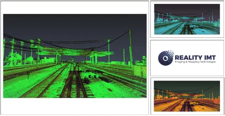
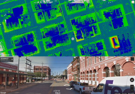
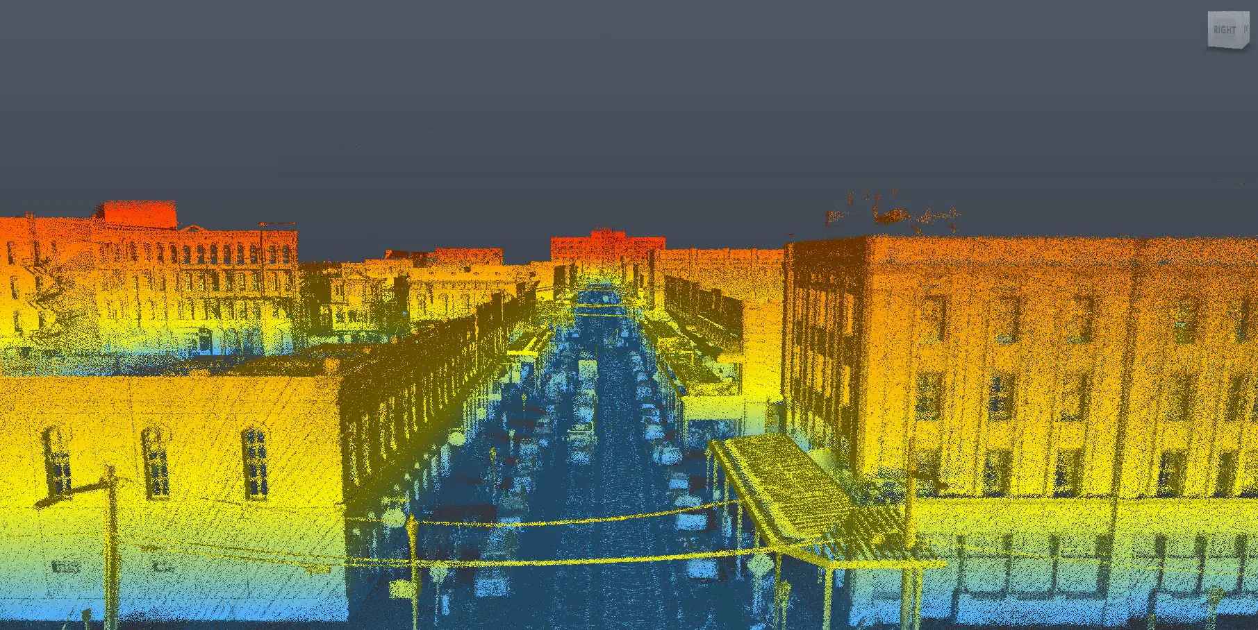
LiDAR (Light Detection and Ranging) mapping services have gained immense popularity in recent years due to their ability to capture highly accurate and detailed 3D data of the urban environment. By utilizing laser pulses to measure distance, LiDAR technology can generate precise elevation models, detect objects, and create high-resolution maps of buildings and terrains. These invaluable insights have significantly improved the planning and decision-making process for city developers and urban authorities.
Enhanced Building Mapping with LiDAR
One of the key applications of LiDAR in city planning is building mapping. Traditional methods of manually surveying buildings for planning purposes were time-consuming and often led to inaccuracies. LiDAR has revolutionized this process by offering a swift, automated, and comprehensive approach to building mapping. Urban planners can now obtain detailed 3D models of buildings, including their height, shape, and architectural features, enabling them to make informed decisions about zoning, infrastructure, and urban development.
Optimizing Urban Infrastructure Development
Efficient infrastructure development is crucial for well-functioning cities. LiDAR mapping services facilitate a deeper understanding of the existing urban infrastructure and identify areas that require improvement or redevelopment. By accurately mapping roads, bridges, and transportation networks, city planners can optimize traffic flow, plan new public spaces, and implement sustainable urban transportation solutions.
Advancing Environmental Conservation
Incorporating LiDAR data in city planning goes beyond just infrastructure. It also plays a pivotal role in environmental conservation efforts. The technology aids in analyzing tree canopies, vegetation coverage, and green spaces, which are essential for maintaining ecological balance and enhancing the quality of life for residents. By integrating these aspects into city planning, we can create more sustainable and eco-friendly urban environments.
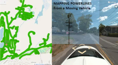
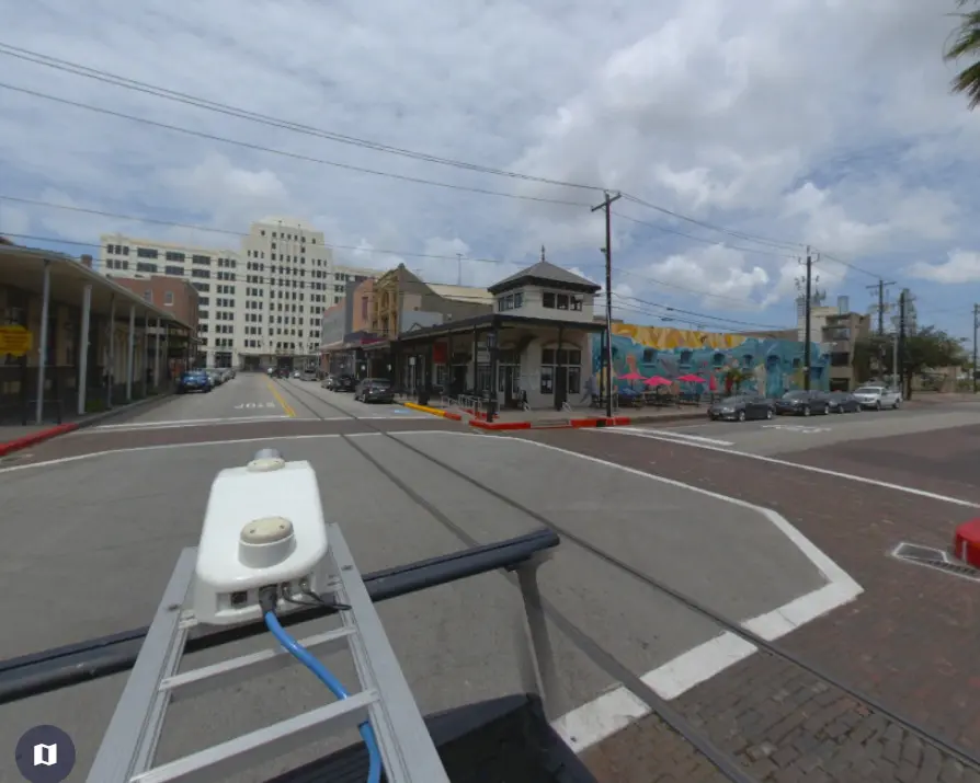
The Synergy of Video Logs and LiDAR
Combining video logs with LiDAR data opens up even more possibilities for city planning. Video logs, recorded through cameras on drones or other platforms, offer real-time visuals of urban areas. When integrated with LiDAR data, urban planners can gain insights into how people interact with the city, identify potential problem areas, and plan for better pedestrian infrastructure.
Accessibility of LiDAR Services
With the increasing demand for LiDAR services, accessibility has become a significant concern. Fortunately, many LiDAR service providers have emerged in recent times, catering to the needs of city planners and developers. Whether you are searching for “LiDAR mapping services” or “LiDAR services near me,” you can find reputable companies like RealityIMT offering state-of-the-art solutions to meet your city planning requirements.
Conclusion:
The combination of video logs and LiDAR mapping services is reshaping the landscape of city planning, revolutionizing the way we design and develop urban environments. With their unparalleled accuracy and efficiency, these technologies provide invaluable insights that help create sustainable, efficient, and livable cities. As we move forward, embracing these technological advancements will be vital in overcoming urban challenges and building a better future for our cities and communities.