Unlocking the Power of Street Level Mapping with LiDAR and 360 Camera: Revolutionizing Circuit Utility Documentation
In today’s fast-paced world, accurate and comprehensive data is crucial for efficient urban planning, infrastructure management, and circuit utility documentation. Thanks to advancements in technology, the field of mobile LiDAR surveying and mapping has emerged as a game-changer, enabling precise street level mapping like never before. This article explores the benefits and applications of mobile LiDAR surveying and mapping, specifically in the context of circuit utility documentation.

Mobile LiDAR Survey: Unleashing the Potential
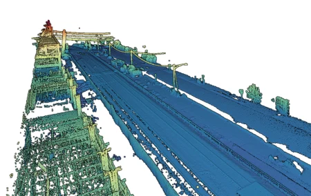
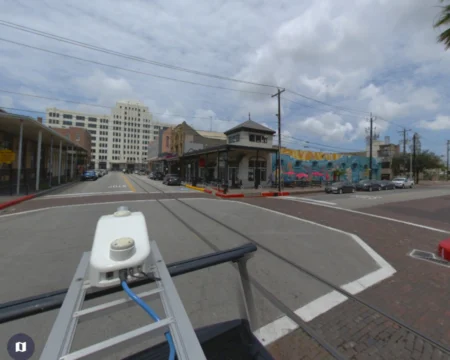
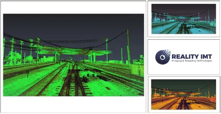
Mobile LiDAR surveying involves the use of advanced laser scanning technology mounted on vehicles or drones to collect geospatial data from a street level perspective. The synergy of mobile LiDAR and 360 camera provides a comprehensive solution for capturing high-resolution point cloud data and panoramic imagery simultaneously. This powerful combination allows for a detailed and accurate representation of the physical environment, making it an ideal tool for circuit utility documentation.
Precise Mapping for Circuit Utility Documentation
Mobile LiDAR mapping has revolutionized the process of circuit utility documentation, offering numerous advantages over traditional methods. Here’s how it facilitates accurate and efficient documentation:
High-Speed Data Collection: Mobile LiDAR systems capture millions of data points per second, providing a rapid and efficient solution for mapping circuit utilities. This saves time and resources while ensuring a comprehensive and detailed representation of the area.
Detailed 3D Visualization: Mobile LiDAR surveying creates highly detailed 3D models of the urban landscape, enabling accurate measurements, precise spatial analysis, and visualization of circuit utilities. This level of detail enhances decision-making processes and helps identify potential challenges and opportunities.
Enhanced Safety and Efficiency: By conducting mobile LiDAR surveys, circuit utility documentation can be performed without disrupting traffic flow or endangering workers. This significantly reduces safety risks and minimizes disruptions to daily activities, resulting in improved efficiency and cost savings.
Accurate Asset Management: Mobile LiDAR mapping provides precise and up-to-date data on circuit utilities, facilitating effective asset management. The data can be integrated into Geographic Information Systems (GIS) platforms, allowing utility companies to track assets, plan maintenance, and respond swiftly to emergencies.
Leveraging LiDAR Topographic Surveys
In addition to circuit utility documentation, LiDAR topographic surveys offer a myriad of benefits for urban planning and infrastructure management. These surveys provide accurate elevation data, enabling precise analysis of terrain, flood risk assessment, and improved land development strategies. By incorporating LiDAR topographic surveys into circuit utility documentation projects, utility companies can make informed decisions based on a holistic understanding of the physical environment.
Conclusion
Mobile LiDAR surveying and mapping, along with the integration of 360 cameras, has transformed the way circuit utility documentation is conducted. With its ability to capture highly detailed and accurate street-level data, mobile LiDAR unlocks new possibilities for efficient urban planning, infrastructure management, and asset documentation. By embracing this advanced technology, utility companies can enhance their operations, improve safety, and make informed decisions for a more sustainable and resilient future. Experience the power of mobile LiDAR surveying and mapping for circuit utility documentation at RealityIMT.com.