In an era driven by technological innovation, Rail LiDAR and 360 Video Mapping have emerged as powerful tools revolutionizing the rail and transportation industries. These advanced technologies are not just buzzwords; they offer practical solutions to address complex challenges and enhance efficiency across various aspects of rail operations.
Understanding Rail LiDAR and 360 Video Mapping
Before we dive into their applications, let’s briefly define these technologies:
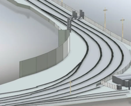
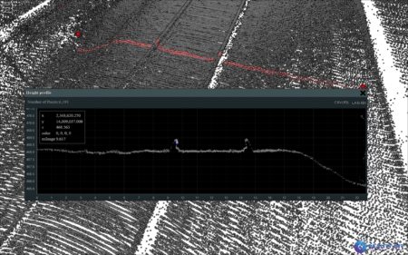
Rail LiDAR (Light Detection and Ranging): Rail LiDAR is a laser-based remote sensing method used for accurately measuring distances and capturing precise 3D data along rail tracks and in their immediate surroundings. It offers a high level of detail, even in challenging environments.
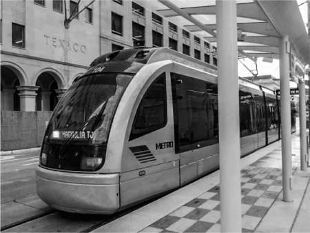
360 Video Mapping: 360 Video Mapping involves the use of panoramic cameras and software to create immersive, 360-degree videos and images. These images offer a comprehensive view of rail assets and environments.
Applications and Benefits
Track Inspection and Maintenance: Rail LiDAR is a game-changer for track inspection and maintenance. It provides highly detailed scans of tracks, switches, and adjacent areas, enabling rail companies to detect defects, wear, and damage early. This proactive approach reduces downtime and enhances safety.
Asset Management: Both Rail LiDAR and 360 Video Mapping play a crucial role in asset management. They facilitate comprehensive documentation of rail assets such as bridges, tunnels, and stations. This data aids in maintenance planning, repair scheduling, and asset lifecycle management.
Safety and Security: 360 Video Mapping is invaluable for enhancing safety and security along rail corridors. It provides real-time monitoring capabilities, allowing operators to detect and respond to security breaches, accidents, or unauthorized access promptly.
Environmental Impact Assessment: Rail projects often have environmental implications. Rail LiDAR can capture precise data about vegetation, terrain, and waterways near rail lines, facilitating environmental impact assessments and ensuring compliance with regulations.
Project Planning and Design: Rail LiDAR and 360 Video Mapping are essential tools in project planning and design. They provide accurate baseline data for new rail infrastructure projects, enabling engineers and planners to make informed decisions and minimize unforeseen challenges during construction.
Training and Simulation: 360-degree videos and images are valuable for training purposes. They can be used to create realistic simulations for operator training, emergency response drills, and safety training programs.
Rail LiDAR and 360 Video Mapping are more than just technologies; they are transformative solutions that enhance efficiency, safety, and accuracy in the rail and transportation industries. These tools are revolutionizing track inspection, asset management, safety monitoring, and environmental impact assessments. By harnessing the power of Rail LiDAR and 360 Video Mapping, rail operators and stakeholders are paving the way for a more efficient, sustainable, and secure rail infrastructure.
For comprehensive Rail LiDAR and 360 Video Mapping solutions that cater to the unique needs of the rail industry, visit realityimt.com today. Our expertise in these cutting-edge technologies ensures that your rail projects are on track for success.