Case Study In the high-stakes world of commercial real estate in Houston, a few inches can mean thousands of dollars. But what if you could eliminate […]
Portfolio Category: Industrial
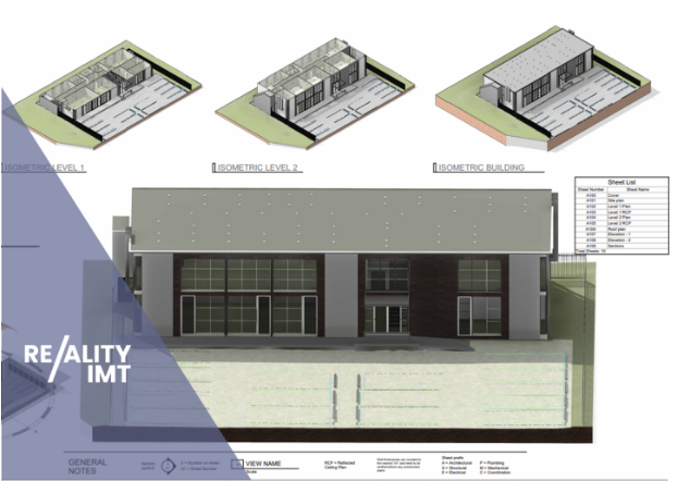
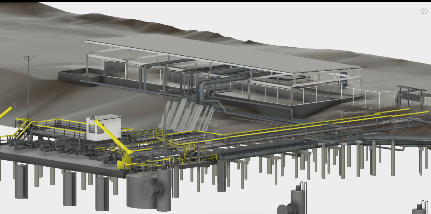
Sample industrial projects delivered by Reality IMT using 3D laser scanning to BIM technology. Digital Twin Solutions for your industrial facilities
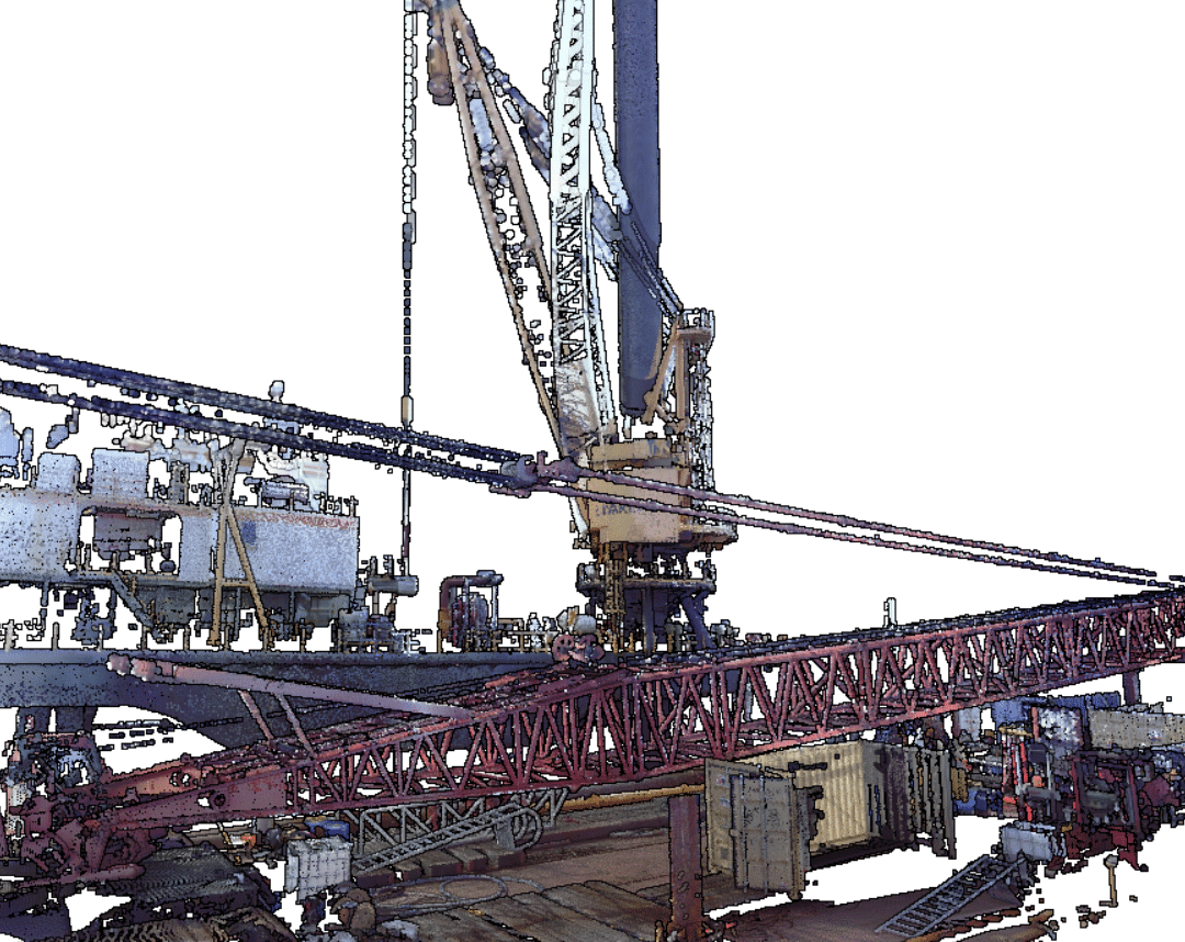
When digitizing a drilling rig with 3D laser scan, a pointcloud is generated as the result of millions of measurements. Sample above shows a directional drilling […]
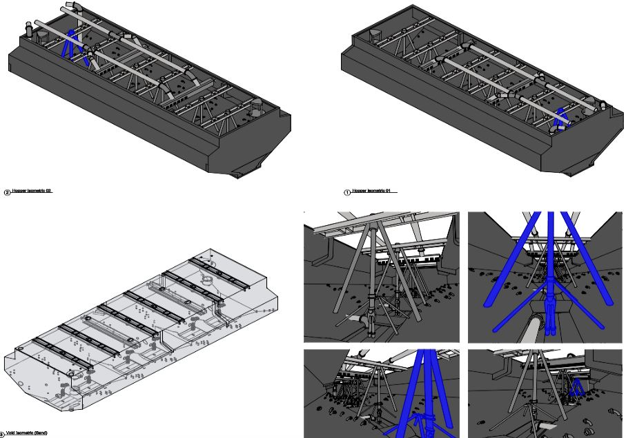
Performing a hopper volumetric survey to understand it’s capacity is not only crucial for project planning, but also for cost estimates and scheduling. When parties cannot […]
While a conventional as-built surveys may provide hundreds of data points for engineering maintenance, a 360 degree laser scan survey provides billions of measurements. This eliminates […]
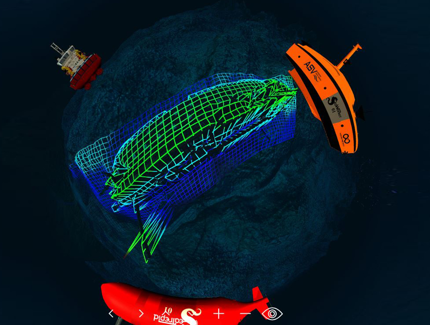
Hydrographic Survey-SONAR/LiDAR Real-time high definition 3D geospatial models of above and below waterline condition. Reality IMT can digitize infrastructure using Rapid Deployment Survey Vessels (RDSV). For […]
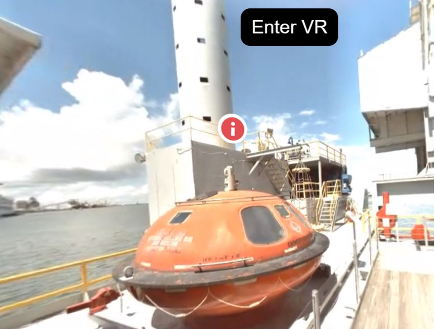
3D Oil Rig-Virtual Walkthrough in 360 degree video. The offshore energy center’s Ocean Star offshore drilling rig museum and education center is located on Galveston Island, […]