Nationwide Service | Houston Headquarters

Historic Preservation · 3D Laser Scanning · New Orleans, Louisiana

Historic Building Laser Scanning in New Orleans

Reality IMT documented an early-20th-century historic building in the Vieux Carré using high-density 3D laser scanning, point-cloud processing, and Scan-to-BIM workflows to support preservation, restoration planning, and future renovation.

Location
New Orleans, Louisiana
Asset Type
Historic Commercial Building
Primary Service
3D Laser Scanning & Scan-to-BIM
Primary Use
Preservation & Renovation Planning

Project Overview

Project Summary

The Vieux Carré Historic District in New Orleans contains some of the city’s most significant architectural fabric. Buildings within the district often include irregular geometry, historic masonry, ornamental façades, balconies, courtyards, and generations of undocumented modifications.

Reality IMT was engaged to document a historic building within the district using high-density 3D laser scanning and Scan-to-BIM workflows. The objective was to create an accurate digital record of the building’s visible existing conditions for preservation planning, renovation design, and future reference.

Because historic structures frequently lack complete or reliable drawings, preservation teams often need a measured baseline before evaluating interventions. The resulting point cloud and derived model provided a coordinated reference for architectural details, spatial relationships, and existing-condition geometry that would have been difficult to capture through conventional field measurements alone.
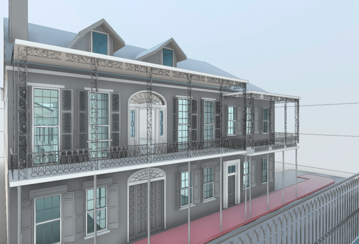
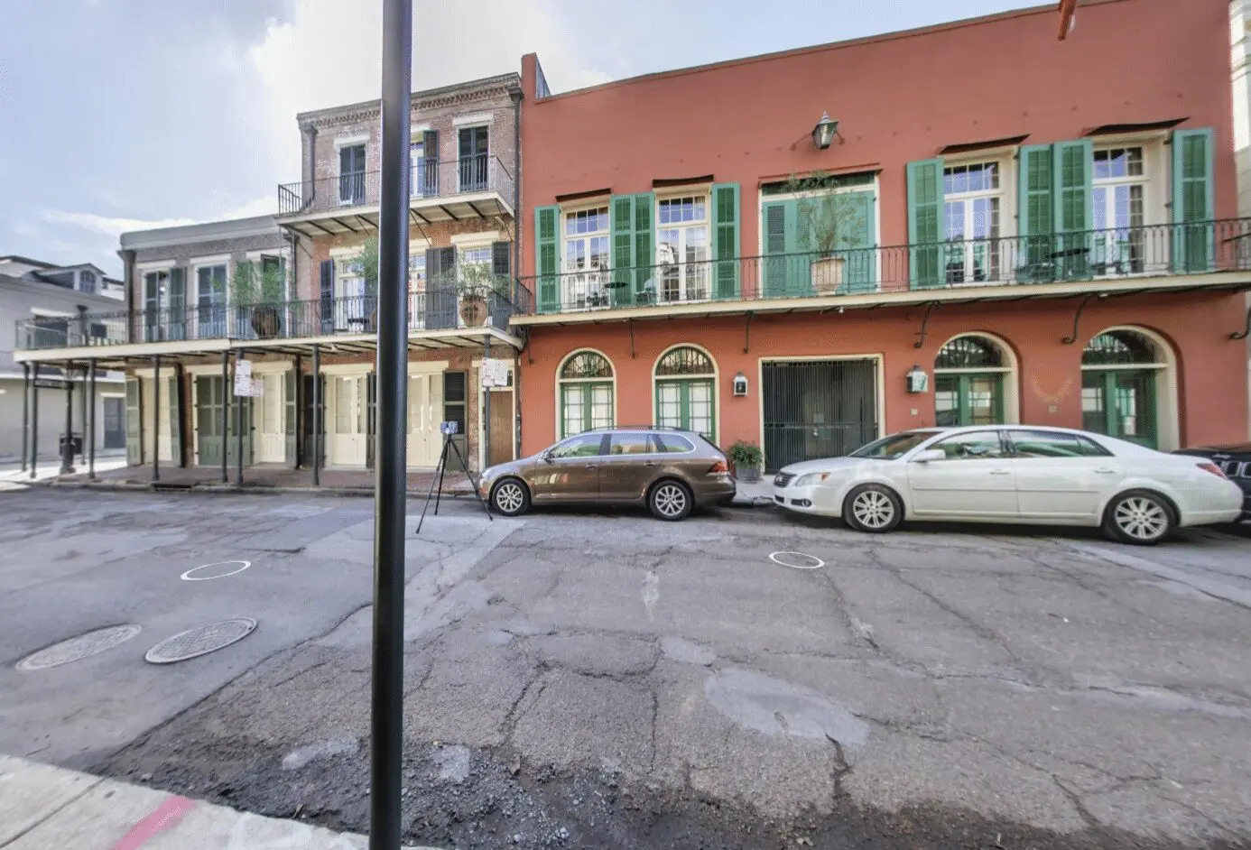
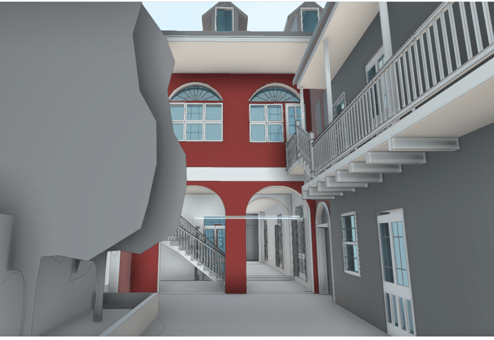
French Quarters 3D Laser Scanning-NOLA As-Built
French Quarters 3D Laser Scanning to BIM

Client Need

Why Historic Buildings Require a Different Documentation Approach

Historic buildings are rarely simple to measure. Their geometry may include settlement, non-orthogonal walls, uneven floor levels, decorative façades, irregular openings, concealed transitions, and alterations performed over many decades.

Irregular Existing Conditions

Historic buildings often contain walls, floors, roofs, and openings that do not align with modern assumptions or standardized dimensions.

Incomplete Legacy Records

Original drawings may be missing, outdated, or inconsistent with later renovations and field modifications.

Preservation-Sensitive Work

Documentation must support future design without unnecessarily disturbing fragile finishes, historic materials, or architectural details.

Project Details

Project Type
Location
Primary Service
Project Purpose
Client
Deliverables

Reality IMT’s Approach

Non-Contact Documentation for a Complex Historic Structure

Reality IMT structured the work to create a measurable record of visible building conditions while minimizing reliance on manual contact measurement and reducing the need for repeated site visits.

Field Planning

The team identified interior and exterior areas, anticipated occlusions, and planned scan positions around complex historic geometry.

High-Density Laser Scanning

Multiple scan positions captured walls, openings, façades, balconies, interior spaces, and other visible architectural features.

Registration and QA/QC

The scan data was registered, reviewed, cleaned, and checked for coverage before production modeling began.

Scan-to-BIM Production

Verified geometry was translated into a coordinated Revit model and supporting CAD documentation for preservation and planning use.

Preservation Value

What Laser Scanning Adds to Historic Preservation

Accurate Baseline Record

The point cloud preserves a measurable record of visible conditions before renovation, restoration, or further deterioration.

Architectural Detail Capture

Dense spatial data helps preserve the relationship between façades, openings, balconies, walls, and interior geometry.

Remote Design Review

Architects and consultants can review conditions from the office and reduce unnecessary return visits during early planning.

Renovation Coordination

Measured digital geometry provides a stronger foundation for restoration drawings, design alternatives, and constructability review.

Future Reference

The digital record can support later maintenance, documentation updates, and preservation decisions.

Reduced Reliance on Assumptions

Project teams can work from measured conditions rather than interpreting incomplete or outdated legacy documents.

Project Outputs

Deliverables Provided

The final deliverables created both a measurable technical reference and a visual record of the building’s current condition.

Registered Point Cloud

High-density spatial data representing the visible interior and exterior geometry of the historic building.

High-Fidelity Revit Model

A coordinated existing-condition model developed from the point cloud for architectural review and planning.

Restoration-Ready CAD Documentation

Measured drawings and reference geometry for preservation and renovation workflows.

3d virtual walkthrough for architectural documentation

High-Resolution Visual Record

Project imagery and scan views preserving the building’s visible architectural character.

Façade and Courtyard Documentation

Focused documentation of exterior and semi-enclosed spaces with significant historic detail.

Ornamental Detail Reference

Digital views of architectural details that may be difficult to measure accurately using manual methods alone.

Project Outcome

A Reusable Digital Record for Preservation and Renovation

The completed documentation provided the project team with a coordinated digital record of the building’s visible existing conditions. The point cloud and model established a stronger basis for preservation planning, design development, and future renovation decisions.

By creating a current baseline before further work, Reality IMT helped reduce dependence on incomplete legacy information and gave architects and consultants a reusable reference for continued project development.

  • Historic building geometry documented with non-contact measurement
  • Current point-cloud and BIM record created for design review
  • Architectural details preserved for future reference
  • Reduced need for repeated field visits during early planning

Visual Documentation

Project Media

French Quarters 3D Laser Scanning-NOLA As-Built

Exterior Façade Documentation

3D laser scanning captured the historic French Quarter façade with millimeter precision for BIM development.

3D Laser Scanning New Orleans

Courtyard & Interior Documentation

High-fidelity scan-to-BIM capture of the historic courtyard, balconies, and architectural details.

More Relevant Work

Related Projects

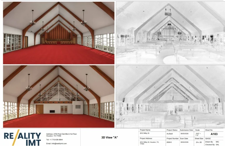
Historic Building Documentation deliverable snapshot for Boynton Chapel Historic Church Documentation by Reality IMT

23 Aug 2023

Boynton Chapel Historic Church Documentation

Reality IMT provided historic building documentation for this historic church totaling approximately 30,000 SF in…

CONTINUE READING
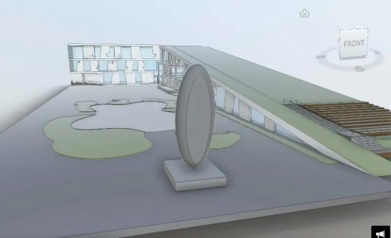
Glassell School of Art-3D As-Built Architectural Survey Houston using HDS Laser Scanning Technology-point cloud Revit BOMA measurements,Commercial As-Built.

5 Nov 2018

Glassell School of Art, Houston

A Hub for Artistic Innovation: The Glassell School of Art, a cornerstone of the Museum of Fine Arts,…

CONTINUE READING
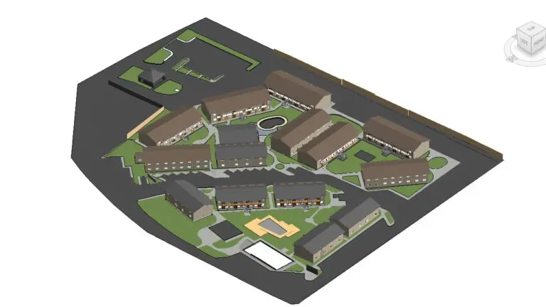
Architectural documentation of a multifamily apartment complex

8 May 2023

700-Unit Multifamily Building Documentation Completed in 30 Days

Reality IMT documented five multifamily communities totaling approximately 620,000 square feet and more than 700…

CONTINUE READING

Need a Historic Building Documented?

Send us the property location, building size, access conditions, available records, and required preservation or renovation deliverables.