Nationwide Service | Houston Headquarters
Municipal Infrastructure · Geovideo · Drainage Inspection

Approximately 100 Miles of Drainage Corridors Documented with Georeferenced Video

Reality IMT combined UAV and street-level geovideo to create a mapped visual record of off-road drainage conditions for a major municipal inspection effort. Defects along the ditches were documented in just a few days then imported into GIS. A GDB was handed over to the City for to help them dispatch maintenance crews in time before major hurricanes occur. Keeping the ditches clear of debris will minimize the flood risks in the City.

Client
Major Texas Municipality
Scope
Approx. 100 Miles
Schedule
Approx. 45 Days
Outputs
Geotagged Visual Inspection Record

Project Overview

Project Summary

Reality IMT supported a municipal drainage-inspection effort covering approximately 100 miles of off-road ditches and drainage corridors. UAV and street-level georeferenced video were used to document visible conditions and create a location-aware visual record that could support review and prioritization.

Infrastructure inspection - GPS video-aerial video mapping project-Reality IMT

Client Need

Project Challenge

Conventional drainage inspection across long off-road corridors can require substantial field time, repeated access, and manual organization of observations.

Off-Road Access

Many drainage segments were not efficiently reviewed from conventional road vehicles.

Long Linear Scope

Approximately 100 miles segmented required a repeatable capture and location workflow.

Condition Prioritization

Reviewers needed visual context tied to place, not disconnected photographs.

Project Details

Project Type
Location
Primary Industry
Project Purpose
Approximate Scope
Client

Reality IMT’s Approach

Georeferenced Video for Rapid Corridor Review

Reality IMT used complementary capture platforms to document accessible and off-road segments while preserving location context.

Route & Access Planning

Drainage segments were organized by access method and capture needs.

UAV & Ground Capture

Aerial and street-level geovideo documented visible conditions.

Location Processing

Video and imagery were tied to corridor position for mapped review.

Condition Review

The visual record supported identification, tagging, and prioritization of visible issues.

Project Outputs

Deliverables Provided

The deliverables below reflect the archived project information and should be matched with project-specific images before publication.

Infrastructure inspection - GPS video-aerial video mapping project-Reality IMT

Georeferenced Video

Mapped visual documentation of drainage corridors.

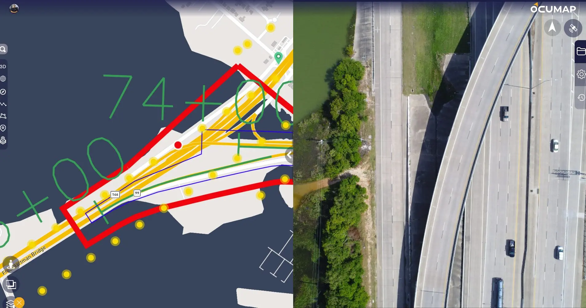
Aerial Video Inspection for Corridors. Locate defects

Aerial Corridor Imagery

UAV-based coverage of off-road areas.

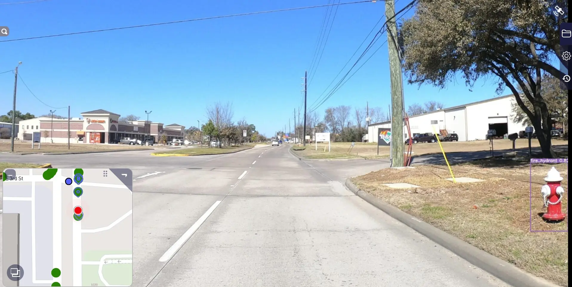
Visual documentation of the right of way using GPS video and street level imagery from a car. Reality IMT

Street-Level Visual Record

Ground-based context for accessible segments.

Condition Tags

Location-aware observations for visible issues.

Mapped Review Environment

A shared way to review conditions across the corridor network.

Repeatable Baseline

A visual reference for future comparison and maintenance planning.

Project Outcome

A Faster Visual Baseline for Municipal Drainage Review

The project created a mapped visual record of approximately 100 miles of drainage corridors in about 45 days. The information supported more efficient review and gave stakeholders a consistent reference for discussing visible conditions and maintenance priorities.

  • Approx. 100 miles documented
  • Approx. 3-week effort
  • UAV and ground geovideo combined
  • Location-aware visual baseline created

Visual Documentation

Project Media

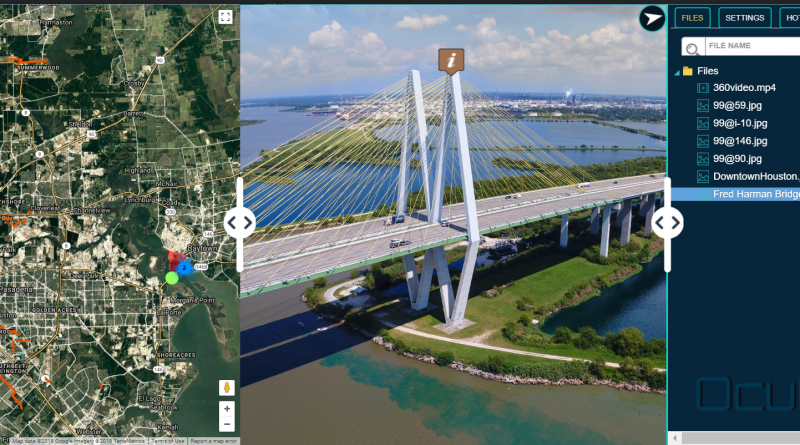
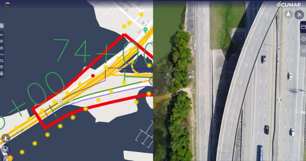
Video Imagery software for aerial geovideo, maps, and data management. OcuMap Software is camera agnostic, supports 360 degree video GPS & panoramic imagery

Drone Inspection Survey

Drone-based video and aerial imagery were collected to document existing drainage conditions and provide comprehensive visual coverage of the inspection corridor.

Aerial Video Inspection for Corridors. Locate defects

Georeferenced Project Data

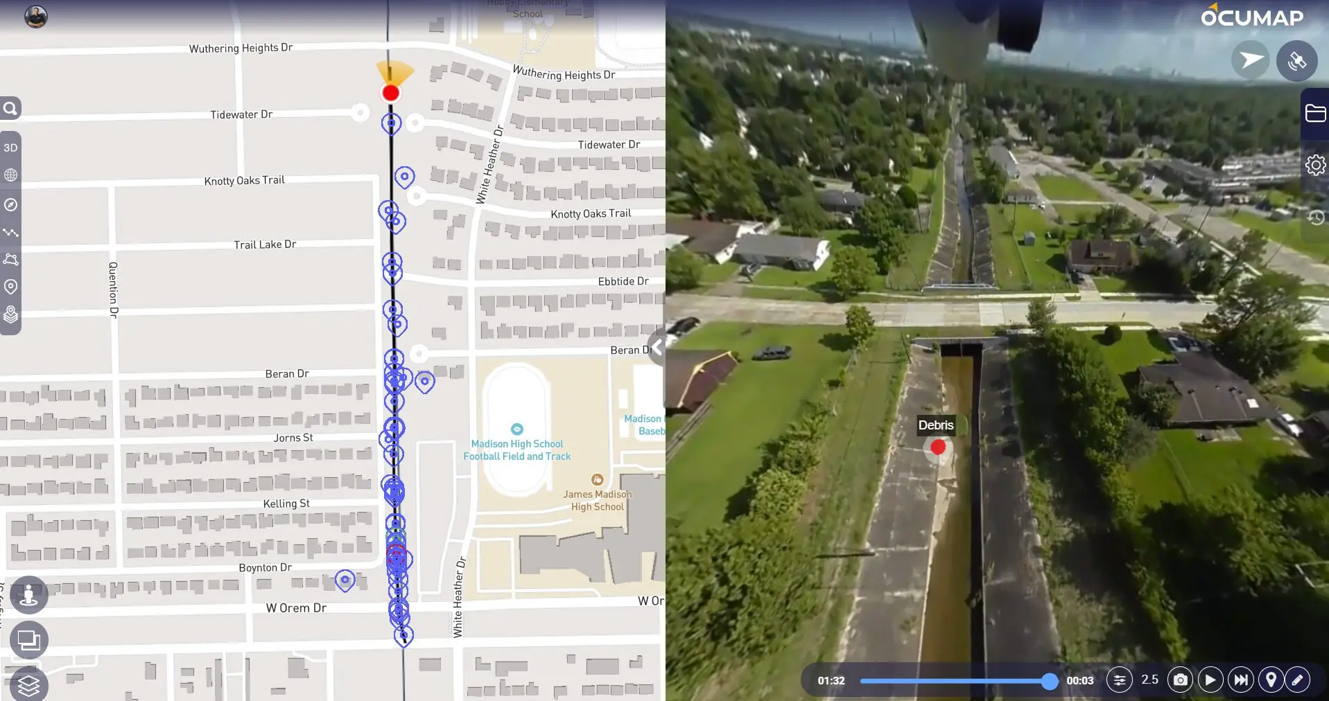
Inspection imagery was processed, georeferenced, and organized into a GIS database, creating a searchable visual inventory of the documented drainage system.

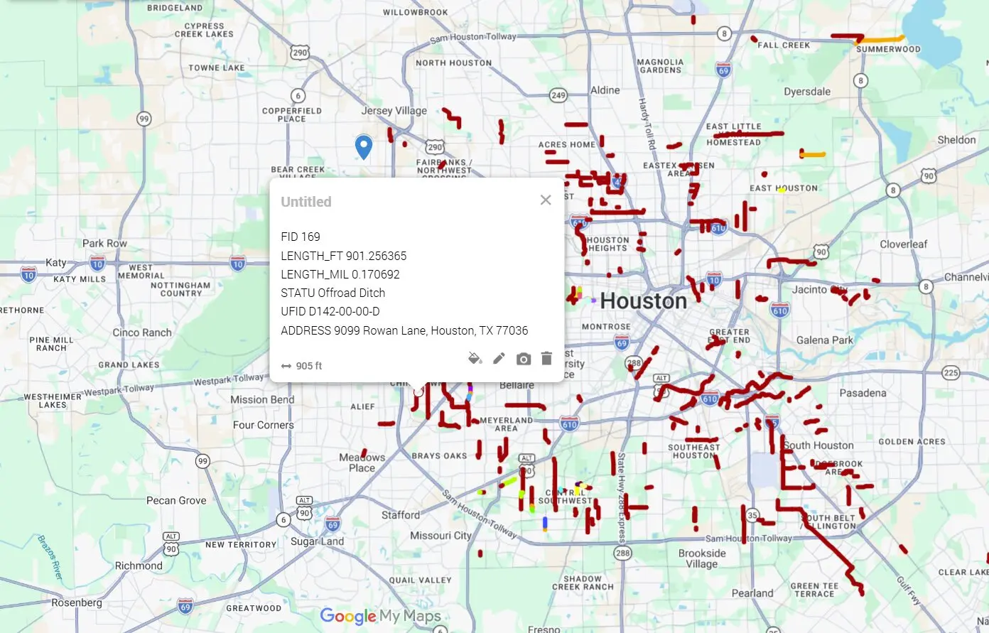
Offroad ditch inspection geovideo, GIS- Reality IMT

GIS Inspection Dashboard

The final deliverable combined interactive mapping with linked drone imagery, allowing stakeholders to locate assets, review conditions, and access inspection data from a single interface.

More Relevant Work

Related Projects

BOMA Area Calculation Services floor plan for Building 3 showing ANSI BOMA Z65.1-2024 interior, lease gross, and building gross areas

17 Jul 2026

BOMA Area Calculations Services for a Two-Building Retail Center

Reality IMT documented Buildings 3 and 4 at 410 W Whitestone Boulevard in Cedar Park,…

CONTINUE READING
Austin industrial scanning services- reality imt

4 Jul 2026

Industrial 3D Laser Scanning Austin | Mechanical Systems Case Study

Reality IMT performed targeted, high-resolution 3D laser scanning of critical mechanical infrastructure at an active…

CONTINUE READING
Exterior elevation scanning and modeling services- Nationwide | Reality IMT

12 Apr 2026

Central Park Post Oak Exterior Measurement Documentation

Reality IMT provided exterior as-built measurements for this commercial building exterior in Houston, Texas.

CONTINUE READING

Need Long Drainage Corridors Documented?

Send us the corridor mileage, access conditions, inspection goals, and required visual or GIS outputs.