Nationwide Service | Houston Headquarters

Rail & Transit · Right-of-Way Mapping · Fiber and PTC Planning

Rail Right-of-Way Imaging for Fiber and PTC Planning

Reality IMT used georeferenced 360 imagery and mapped asset tagging to create a shared visual record of active rail right-of-way for fiber and Positive Train Control planning.

Asset
Active Commuter-Rail ROW
Primary Use
Fiber and PTC Planning
Capture
High-Rail 360 Imagery + GPS
Output
Mapped Visual Record and Asset Tags

Project Overview

Project Summary

Reality IMT supported a rail-construction team planning fiber-optic installation and Positive Train Control work across a large commuter-rail network. Engineers needed current visual information about access points, visible utilities, structures, signals, and right-of-way conditions before construction decisions and bids could be finalized.

A high-rail-mounted panoramic imaging system with GPS and inertial positioning was used to collect continuous corridor imagery during normal rail access. The data was processed and made available through a mapped web viewer so project stakeholders could review conditions, tag visible assets, and coordinate field resources from the office.

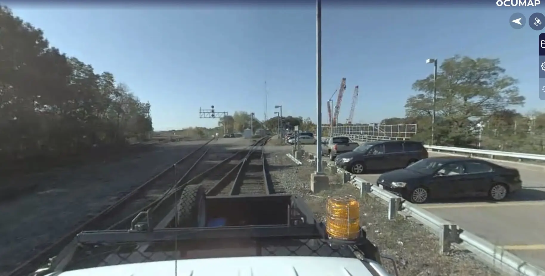
360 video mapping for railroads. GPS based imagery for PTC signal documentation

Client Need

Project Challenge

The project team needed corridor-wide context while managing rail safety, operational access, and the inefficiency of sending specialized engineers into the field for routine visual verification.

Active Right-of-Way

Field access required rail-qualified personnel and coordination with ongoing operations.

Distributed Stakeholders

Signal, PTC, construction, and engineering teams needed access to the same corridor information.

Planning Before Construction

Access, structures, utilities, and visible conditions had to be understood before bids and field deployment.

Project Details

Project Type
Location
Facility / Asset Type
Project Purpose
Client

Reality IMT’s Approach

High-Rail Capture and Shared Mapped Review

The workflow was designed to collect corridor context efficiently and make it usable by project teams without requiring every reviewer to visit the right-of-way.

System Setup and Training

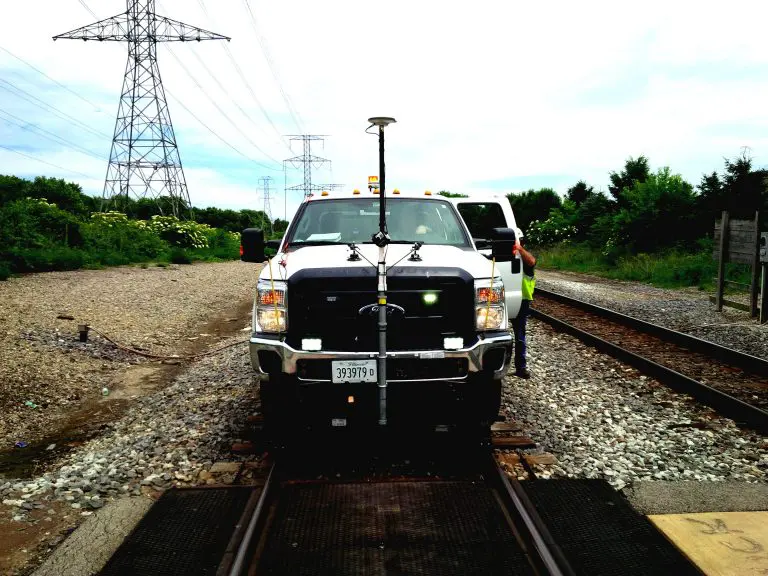
The panoramic camera, positioning system, and workstation were mounted on a high-rail vehicle and field staff were trained to operate the system.

Corridor Capture

Continuous imagery and location data were recorded during scheduled high-rail access.

Remote Processing

Reality IMT processed the collected imagery and positioning information after each field run.

Mapped Review and Tagging

Stakeholders reviewed the corridor, tagged visible assets, and used the shared visual record for coordination.

Project Outputs

Deliverables Provided

Georeferenced 360 Imagery

Continuous visual documentation tied to corridor position.

Mapped Web Viewer

A shared browser-based environment for remote corridor review.

Visible Asset Tags

Signals, structures, access points, and other features tagged with location context.

Planning Reference

A reusable visual record for fiber routing, staging, bidding, and coordination.

Stakeholder Access

One source of visual information for owner, contractor, engineering, and field teams.

Future Reference

Corridor context that could support maintenance and later project decisions.

Project Outcome

Corridor Context Available Without Repeated Field Visits

The mapped visual record allowed project stakeholders to review the same right-of-way conditions during meetings, identify visible assets, and make field-deployment decisions with better context. It also allowed specialized engineering staff to focus more of their time on design and implementation rather than basic corridor reconnaissance.

The archived publications contain aggressive speed, cost-savings, and efficiency claims. Those figures have been omitted from this draft until independently verified.

  • Shared visual record for distributed teams
  • Supported fiber and PTC planning
  • Reduced dependence on repeat reconnaissance
  • Asset tags tied to corridor location

Visual Documentation

Project Media

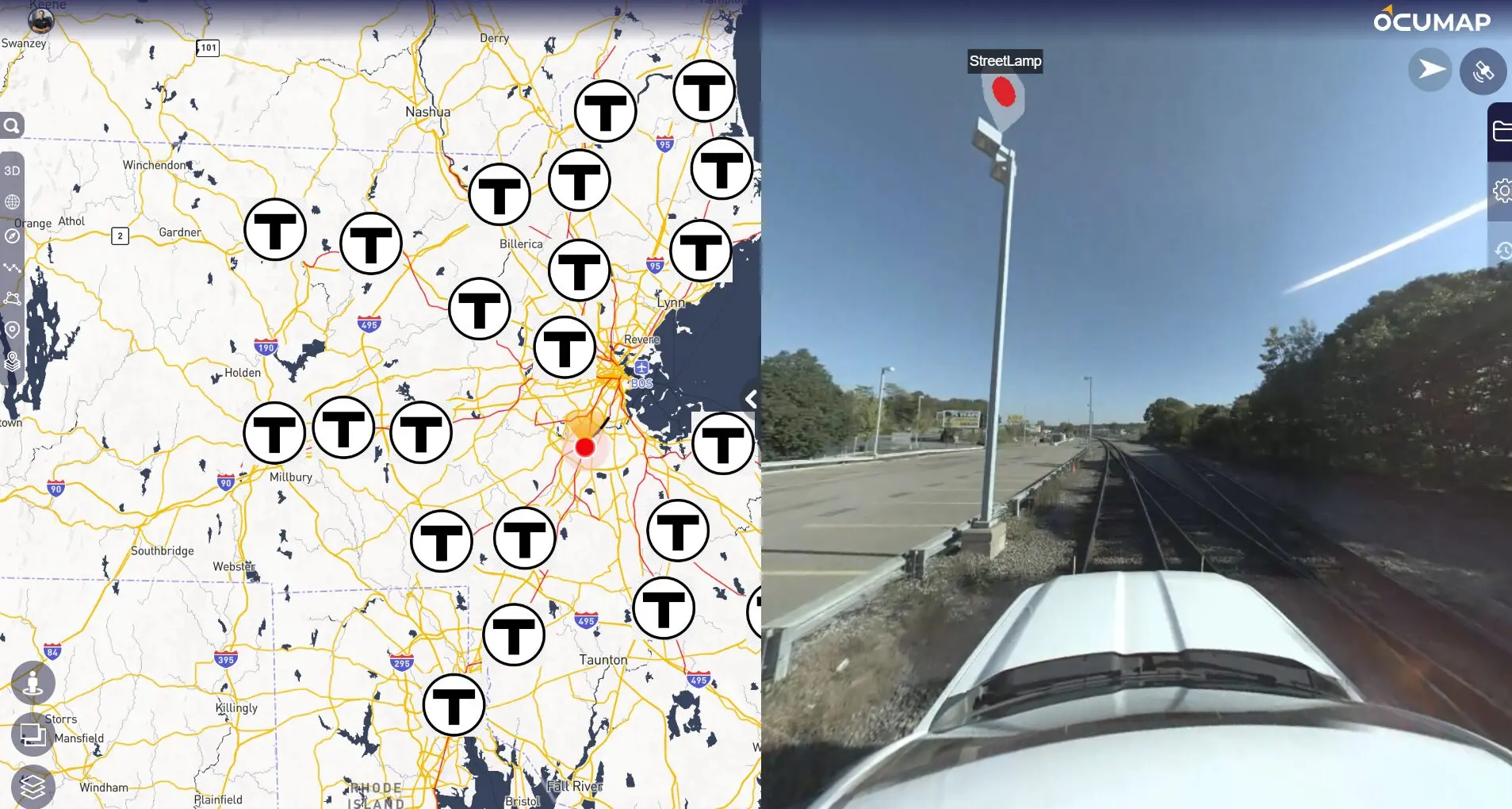
Visual right of record for rail network- Boston

Field Capture

Hi-Rail Mounted 360 degree camera with RTK GPS receiver logging the entire nework

Railway video log using GPS cameras

Mapped Visual Record

Web-based visual record showing all routs, stations, and geolocated PTC assets

More Relevant Work

Related Projects

rail right of way mapping with LIDAR and 360 cameras

22 Apr 2020

40-Mile Commuter-Rail Corridor Documented with LiDAR and 360 Imagery

Reality IMT supported a commuter-rail documentation program covering approximately 40 miles of active right-of-way. The…

CONTINUE READING
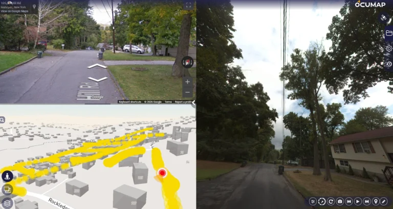
Street Level Photo data collection for utility mapping

11 Sep 2024

Utility-Pole and Distribution-Asset Mapping at Network Scale

Reality IMT supported a large utility asset-documentation program using mobile and ATV-based imagery, RTK positioning,…

CONTINUE READING

Need Rail Right-of-Way Conditions Available to Your Project Team?

Send us the corridor length, access method, project purpose, visible assets, and required viewer or GIS outputs.